Geological Mapping: What It Is, Who Does It, and Why We Do It
Richard C. Berg, Director, Illinois State Geological Survey

Working, learning, and living in the geosciences.
Event Archive
This webinar series is part of the The Value of Geologic Mapping, 2018 project, and introduces geologic mapping in the Great Lakes region, showcases projects from the Great Lakes Geologic Mapping Coalition, and reviews planning decisions made based on their work.
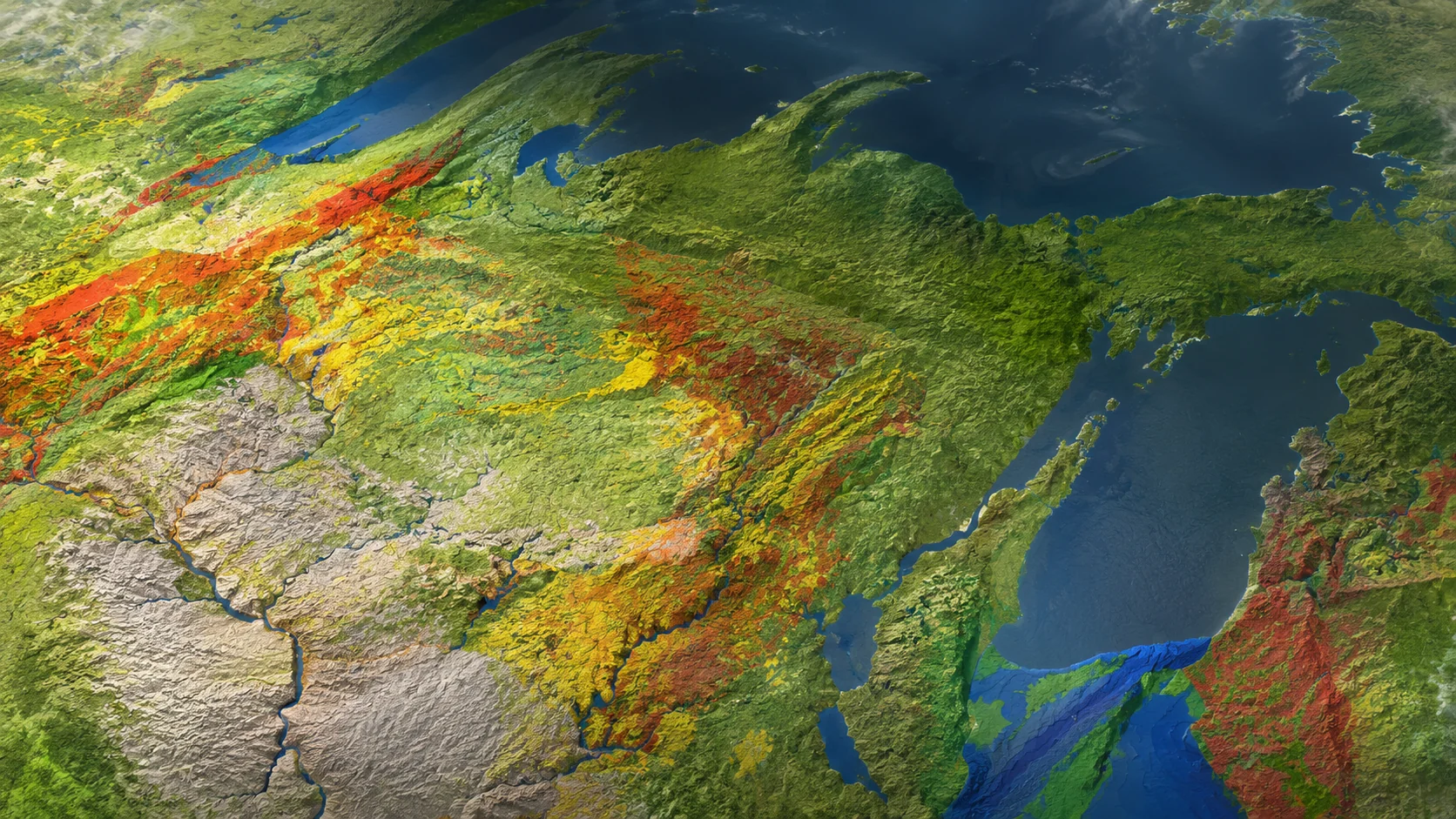
Less than one-third of the U.S. is mapped at the level of detail necessary to make informed planning decisions on a local scale concerning natural resources, natural hazards, infrastructure planning, and environmental stewardship. In the Great Lakes region, the Great Lakes Geologic Mapping Coalition (GLGMC), a group including U.S. and Canadian state and provincial geological surveys, is producing detailed 3D geologic maps that are helping to provide decision-relevant information to Great Lakes state communities. Due to similar regional geology, these state surveys can work together, sharing their expertise and resources so that each can better address geologic issues in their area. Working with the communities, the GLGMC provides and makes maps that solve problems such as groundwater contamination and resource development.
This webinar will introduce geologic mapping in the Great Lakes region, showcase projects from the Great Lakes Geologic Mapping Coalition, and review planning decisions made based on their work. Speakers from the Illinois, Minnesota, and Michigan State Geological Surveys will discuss case studies of recent and ongoing projects in their states where geologic maps inform major decisions and empower communities to protect their people, resources, and economies.
This webinar is co-sponsored by the American Association of State Geologists, Association of Engineering and Environmental Geologists, American Institute of Professional Geologists, Environmental and Engineering Geophysical Society, Geological Society of America, National Association of State Boards of Geology, Society for Sedimentary Geology, and the Society of Exploration Geophysicists’ International Exposition and 88th Annual Meeting in Anaheim.
Richard C. Berg, Director, Illinois State Geological Survey
Harvey Thorleifson, Director, Minnesota Geological Survey
Jason Thomason, Associate Hydrogeologist and Section Head; Hydrogeology and Geophysics, Illinois State Geological Survey
John Yellich, Director, Michigan Geological Survey at Western Michigan University