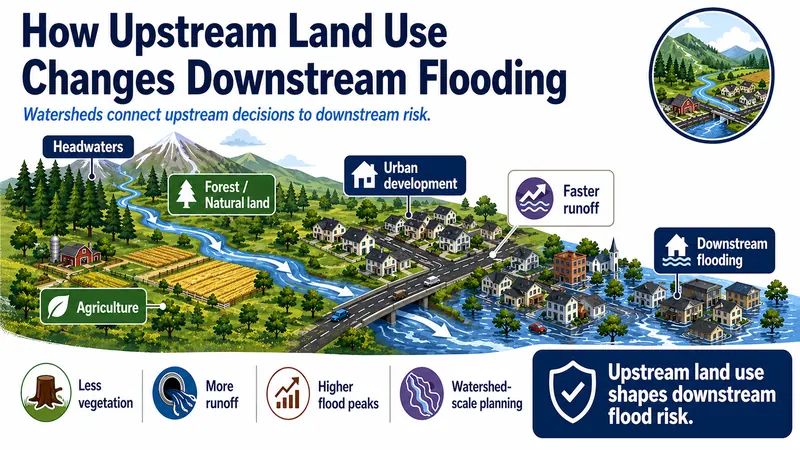
How Upstream Land Use Changes Downstream Flooding
Shows how upstream land use can change runoff, sediment movement, and flood peaks downstream.


Working, learning, and living in the geosciences.
Explainer Collection
A collection of practical flood explainers for policy, planning, resilience, and public communication use.
This collection explains flood topics that are often misunderstood in policy and public discussions, including flood probability, river behavior, floodplains, runoff, levees, and the difference between hazard and risk.
Use these guides to support briefings, planning conversations, land-use discussions, infrastructure decisions, and clearer communication about flood-related issues.
8 results
Shows how upstream land use can change runoff, sediment movement, and flood peaks downstream.
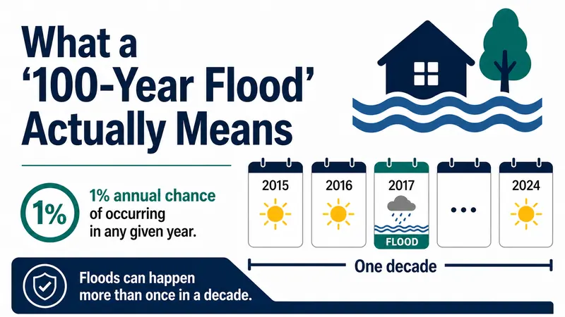
Explains the concept of a 100-year flood and how it refers to annual probability, not a once-per-century schedule.
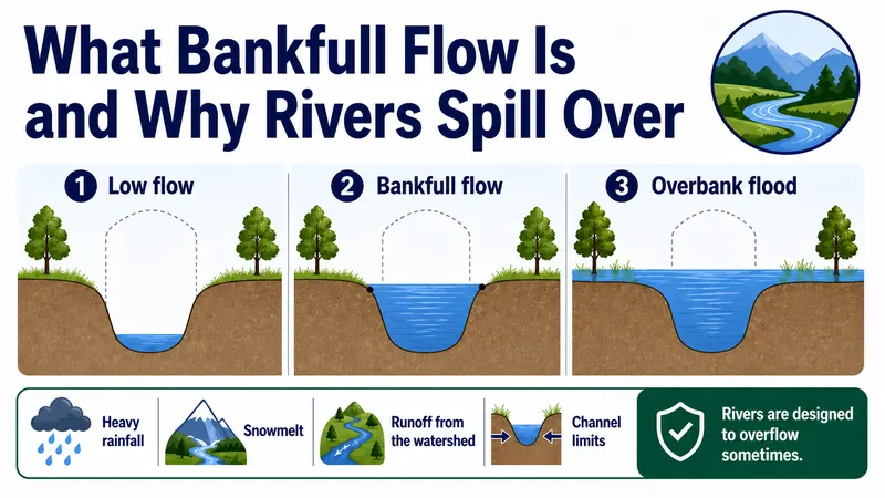
Describes what bankfull flow and overbank flooding are, and why rivers naturally spill onto floodplains.
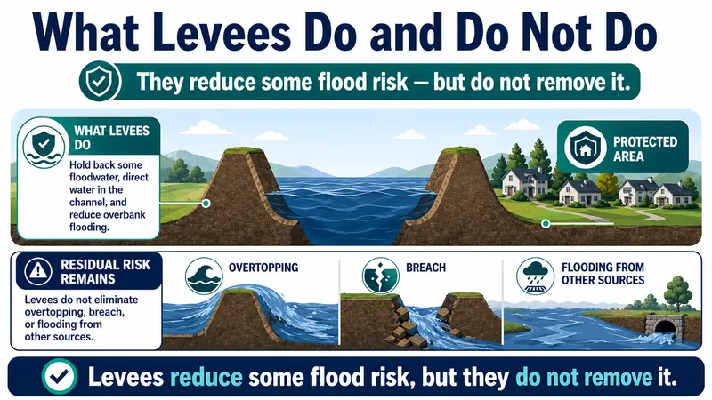
Clarifies how levees can reduce some flood impacts but do not eliminate flood risk.
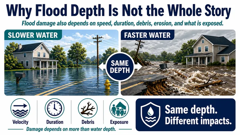
Discusses why flood impacts depend on more than water depth alone.
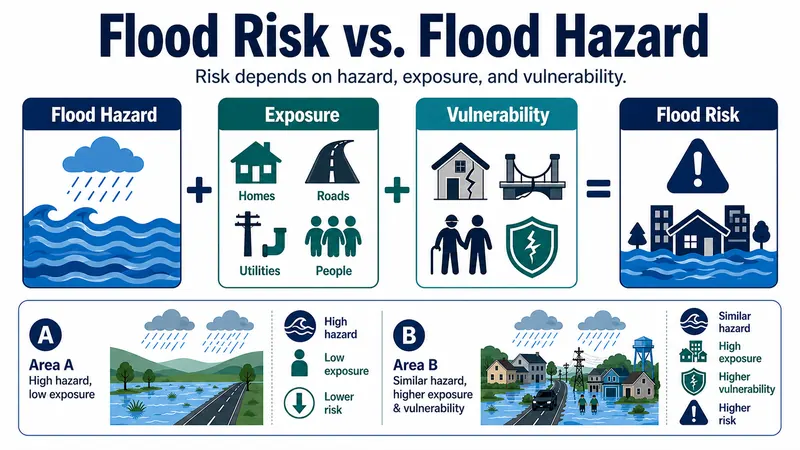
Walks through the differences between flood hazard, exposure, vulnerability, and risk.
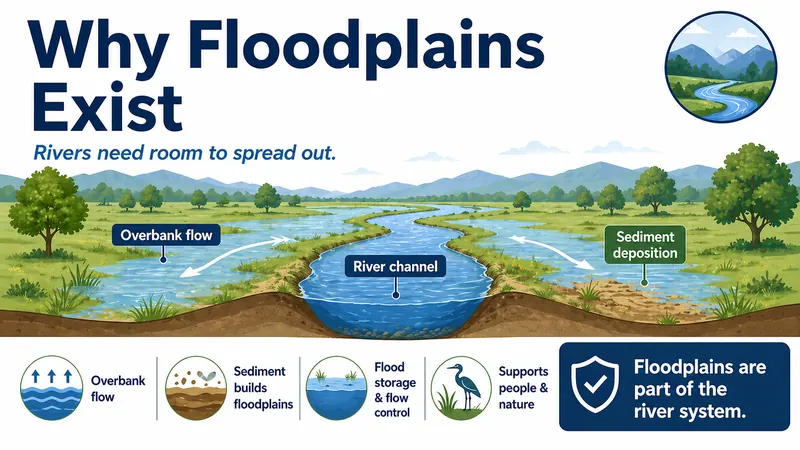
Explores how floodplains, which are natural parts of river systems, form over time as rivers overflow, slow down, deposit sediment, and shift across the landscape.
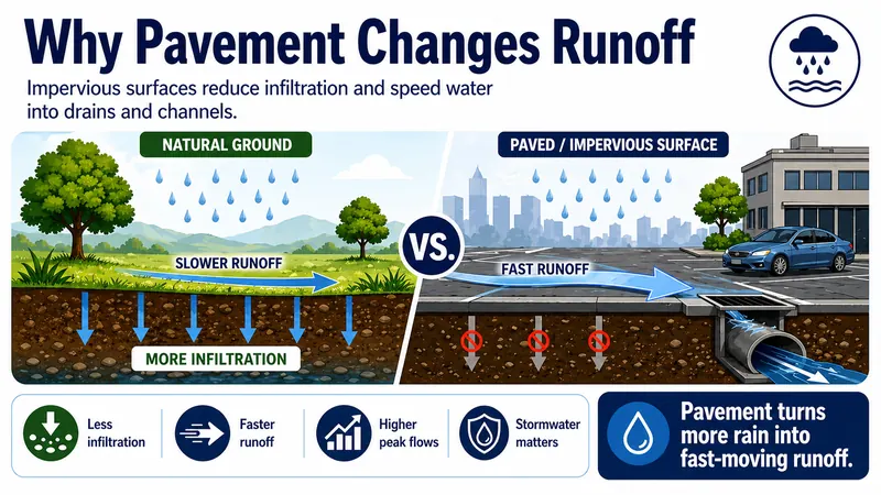
Breaks down how pavement and other impervious surfaces reduce infiltration, speed runoff, and can increase flood peaks downstream.
No items matched that search.