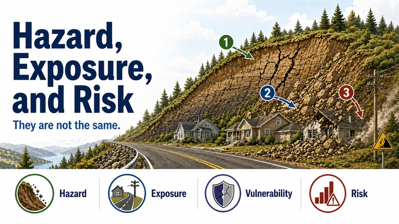
Hazard, Exposure, and Risk Are Not the Same
Explains the difference between hazard, exposure, vulnerability, and risk using land-instability examples.


Working, learning, and living in the geosciences.
Explainer Collection
A collection of practical guides that explain how ground movement, subsidence, erosion, slope failure, and hidden underground conditions affect land-use, infrastructure, and public safety decisions.
This collection explains land-instability topics that are often misunderstood in policy and public discussions, including landslides, rockfall, subsidence, sinkholes, riverbank erosion, earth fissures, unstable slopes, hidden voids, and the difference between hazard, exposure, and risk.
Use these guides to support briefings, planning conversations, infrastructure siting, development review, hazard communication, mitigation planning, and clearer discussion of ground-movement risks.
20 results
Explains the difference between hazard, exposure, vulnerability, and risk using land-instability examples.
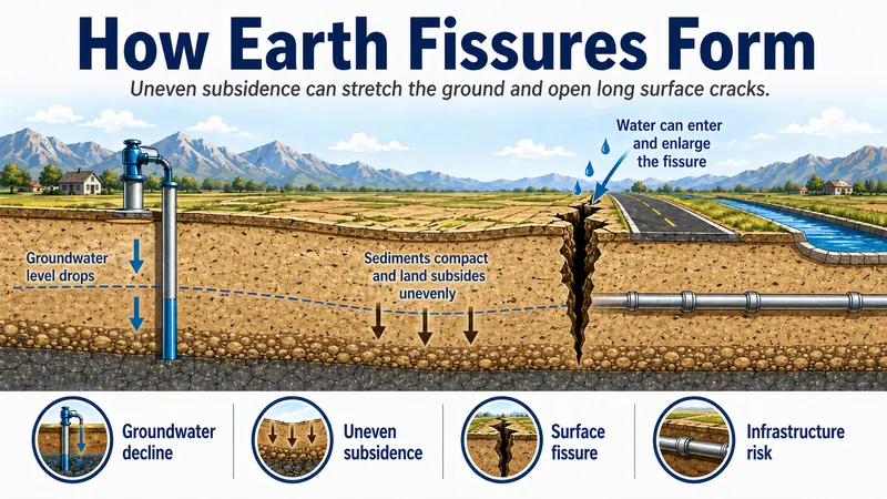
Explains how earth fissures can form where uneven subsidence stretches basin-fill sediments, and why these cracks matter for infrastructure and land-use planning.
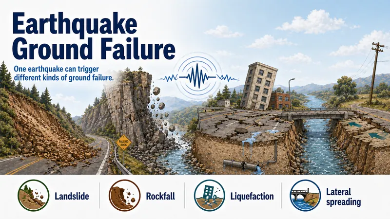
Explains how earthquake shaking can trigger several kinds of ground failure, including landslides, rockfalls, liquefaction, and lateral spreading.
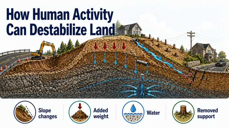
Explains how human activities such as grading, excavation, added fill, drainage changes, vegetation removal, mining, and groundwater pumping can increase land instability.
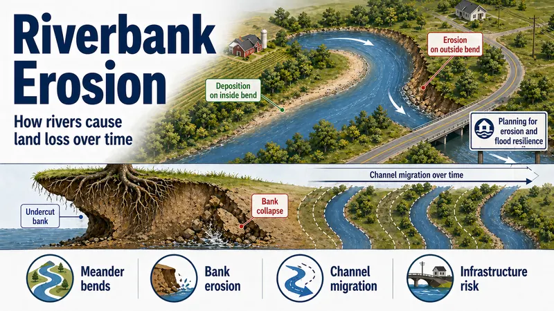
Explains how rivers naturally erode and reshape their banks, especially during high flows, along outside bends, and as channels migrate across floodplains.
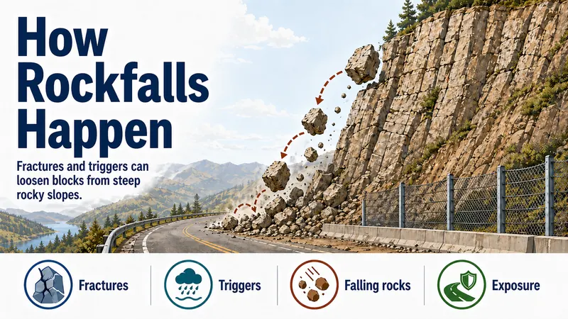
Explains how rockfalls occur when fractured rock blocks detach from steep slopes, cliffs, bluffs, or road cuts and fall, bounce, or roll downslope.
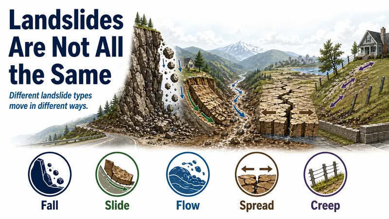
Explores the several kinds of ground movement which fall under the term landslide, including falls, slides, flows, spreads, and creep.
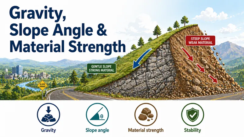
Describes how gravity, slope angle, and material strength work together to influence whether slopes are more likely to remain stable or move.
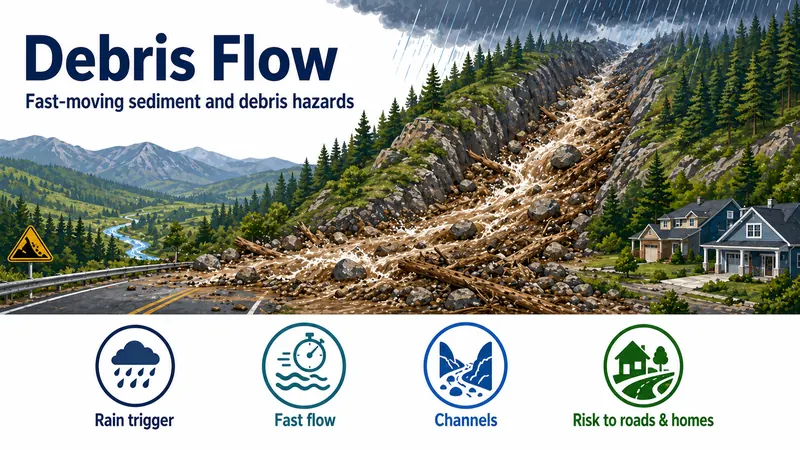
Explains that debris flows are fast-moving mixtures of water, sediment, rock, vegetation, and debris that can travel quickly through channels and threaten people and infrastructure downslope.
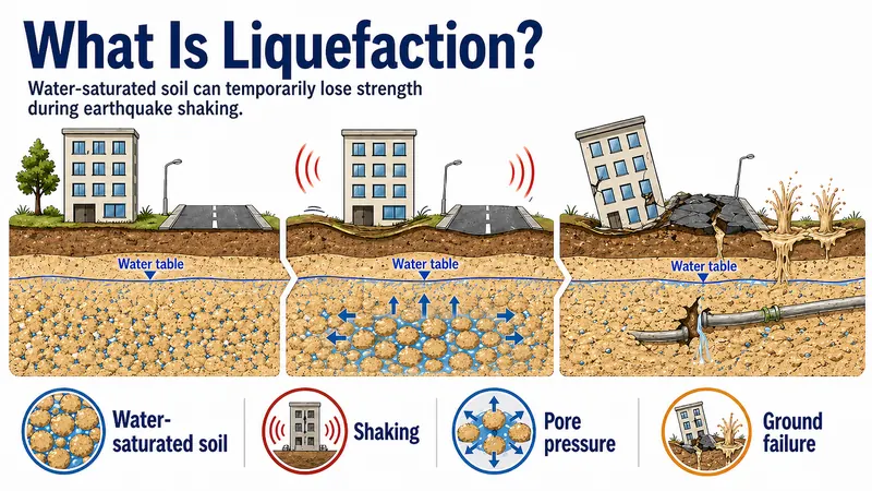
Explains how liquefaction occurs when loose, water-saturated sandy or silty soils temporarily lose strength during earthquake shaking.
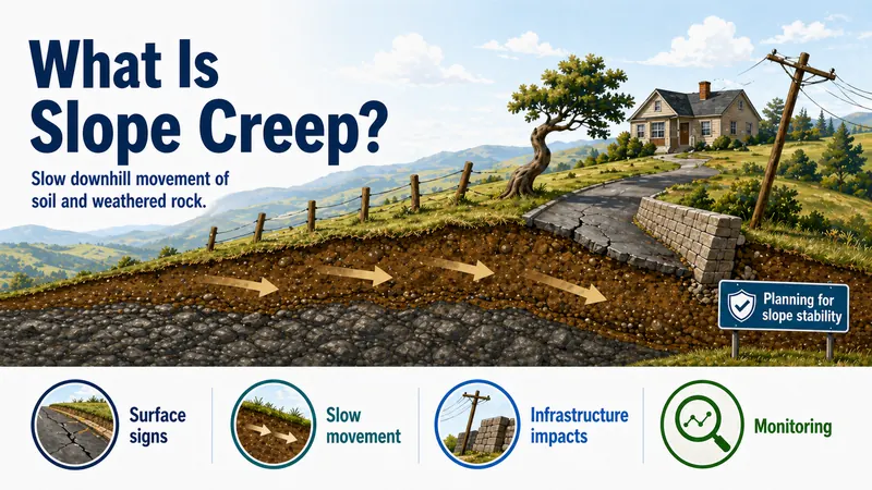
Explains that slope creep is very slow downslope movement of soil and weathered rock that can cause long-term damage to roads, foundations, retaining walls, pipelines, and utilities.
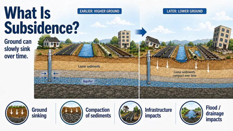
Explains that subsidence is the sinking of the land surface and can be caused by groundwater withdrawal, deeper fluid extraction, mining, drainage of organic soils, or compaction of soils and sediments.
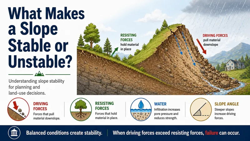
Explains how slope stability depends on the balance between driving forces that pull material downslope and resisting forces that hold soil and rock in place.
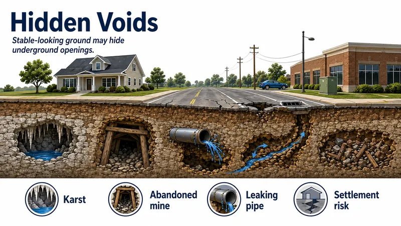
Explains how hidden underground voids can form naturally or through human activity and lead to settlement, cracking, or collapse at the surface.
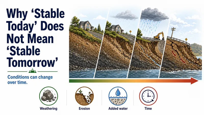
Explains why slope stability is dynamic and how weathering, erosion, water, vegetation loss, earthquakes, and human activity can change ground conditions over time.
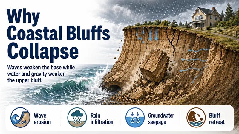
Explains how coastal bluffs can collapse when waves erode the base while rainfall, groundwater, fractures, and gravity weaken the upper bluff.
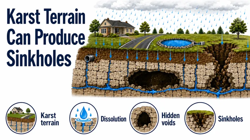
Explains how karst terrain forms where soluble rocks such as limestone dissolve underground, creating cavities, conduits, voids, and sinkhole hazards.
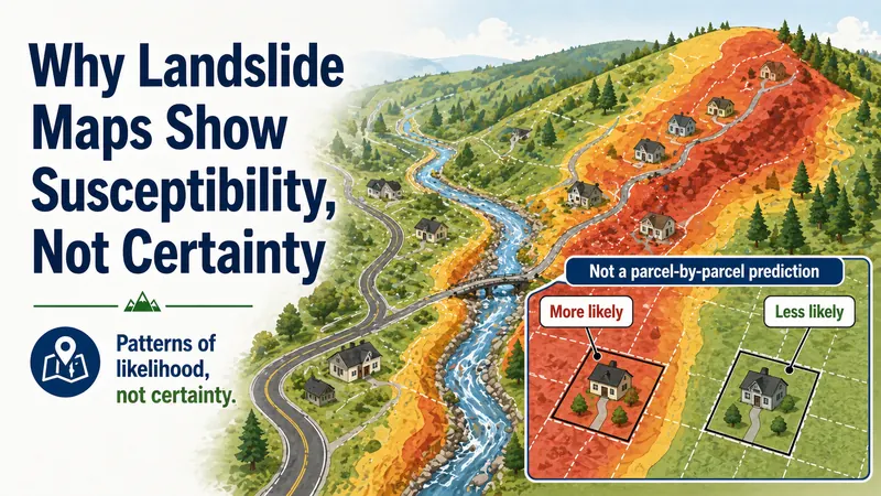
Explains why landslide susceptibility maps show relative likelihood, not exact predictions of when or whether a specific site will fail.
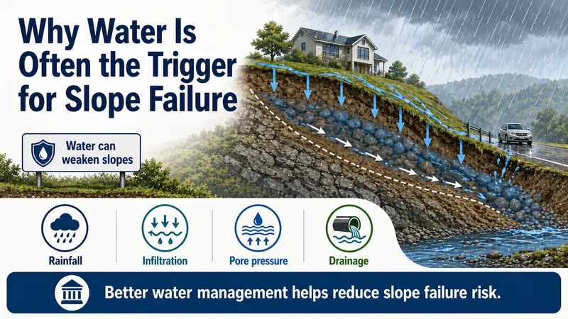
Shows how water can trigger slope failure by adding weight, reducing friction, and increasing pore pressure inside soil and rock.
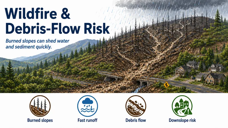
Explains how wildfire can increase landslide and debris-flow risk by removing vegetation, weakening roots, exposing soil, increasing runoff, and mobilizing sediment and debris during storms.
No items matched that search.