

Intersection Topic
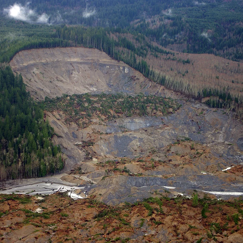
Landslides
Landslides affect all 50 states and U.S. territories, where they cause [25 to 50 deaths and more than $1 billion in damages](https://www.usgs.gov/faqs/how-many-deaths-result-landslides-each-year) each year. Geoscientists study and monitor landslides to identify at-risk areas, prepare populations, and improve our understanding of why, when, and where landslides happen.
The Basics
Landslides are masses of earth, rock, or debris that move down slopes. Landslides are triggered by one event, but many causes can weaken slopes over time and make them more likely to fail when there is a triggering event. These causes can be both natural and artificial. Landslides often occur in areas with oversteepened slopes, weak soils/bedrock, or de-vegetated slopes (whether by human deforestation or natural events such as wildfires).[1] Some of the most damaging landslides are triggered by water, typically from intense short-term rainfall or long-term saturation of the slope. Both natural and human activities (such as irrigation or seepage) can saturate hillsides. Earthquakes and volcanic eruptions also cause damaging landslides.[1]
Why do landslides matter?
Landslides affect all 50 states and U.S. territories, though mountainous regions such as the Pacific Coast range, the Rockies, the Appalachians, Alaska, and Hawaii bear the most severe risk. The U.S. Geological Survey estimates that each year in the United States, landslides cause the deaths of 25 to 50 people and losses of at least $1 billion.[2]
How does geoscience help?
Geoscientists map areas that may move so homeowners and emergency managers can plan ahead. They map these areas by locating old landslide features, which indicate areas that have moved in the past. They evaluate the slopes’ vulnerability by studying their features such as soil, bedrock, slope steepness, vegetation cover, and water table height. They also study the triggers of both natural and artificial landslides.
References
1 Landslide Types and Processes, U.S. Geological Survey, https://pubs.usgs.gov/fs/2004/3072/fs-2004-3072.html
2 How many deaths result from landslides each year?, U.S. Geological Survey, https://www.usgs.gov/faqs/how-many-deaths-result-landslides-each-year
Learn More
Introductory Resources
-
Landslide Basics, U.S. Geological Survey
A definition of landslides, list of factors that can cause landslides, brief overview of where landslides occur, and discussion of why it is important to study landslides. -
Landslide Types and Processes, U.S. Geological Survey
Provides an overview of the classification of landslides and a thorough list of landslide causes. Discusses the causes of the most damaging landslides. Includes diagrams of different landslide types. -
The Landslides Handbook- A Guide to Understanding Landslides, U.S. Geological Survey
This comprehensive resource for a lay audience includes detailed information on types of landslides, where landslides occur, landslide causes, and landslide effects/consequences. Also includes extensive sections on evaluating landslide hazard, communicating landslide hazard, and techniques for mitigating landslides.
Resources for Educators
-
Education GeoSource Network (EGS), AGI
Search for landslide resources related to professional resources, curricula & instruction, teaching media, outreach programs, and other EGS collections. -
NGSS Performance Expectations, Next Generation Science Standards
3-ESS3-1, 4-ESS3-2, MS-ESS3-2, HS-ESS3-1 -
NGSS Disciplinary Core Ideas, Next Generation Science Standards
ESS3.B
Additional Resources
Geoscience in Society Webinars
See how geoscience informs our understanding of societal issues.
Watch webinarsPolicy Resources
Search related case studies, factsheets and other policy resources.
Browse policy resourcesFAQs
Browse frequently asked questions related to the intersection of geoscience and society.
Browse FAQsEARTH Magazine
Browse related articles from EARTH magazine.
Browse EARTH MagazineEnvironmental Awareness Series
Read our reports showcasing how geoscience is used to address societal concerns.
Browse reportsExplore Related Topics
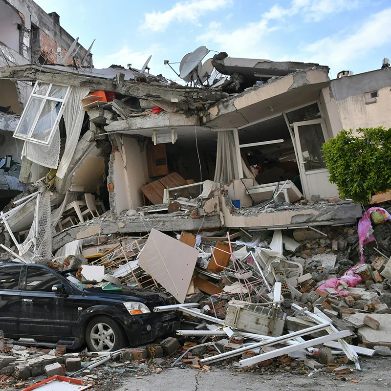
Earthquakes
Since 1900, earthquakes in the United States have resulted in over 1300 deaths and direct damages totaling more than $51 billion. While the West Coast and Alaska have the highest risk, history shows that major earthquakes can also affect the Central and Eastern United States.
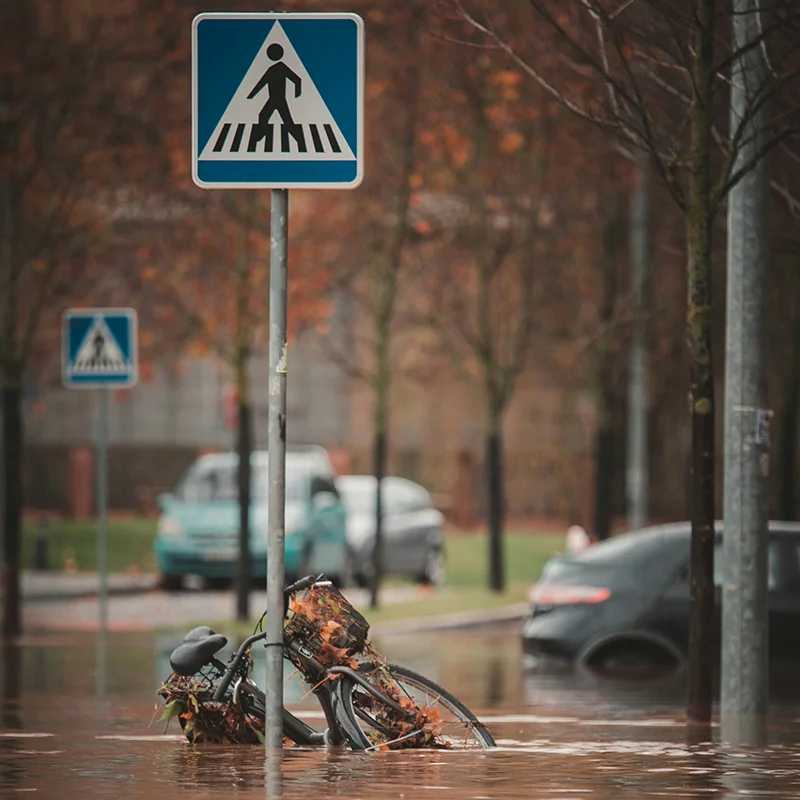
Floods
Flooding is the most common and costliest natural hazard facing the United States. Each year, flooding causes billions of dollars in damages and dozens of deaths nationwide.
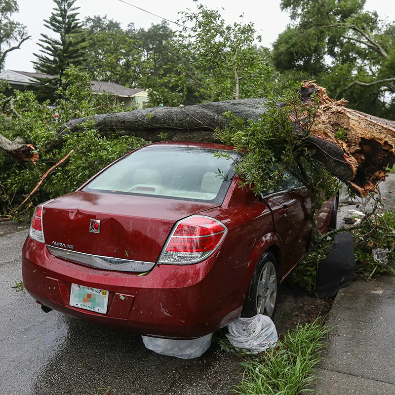
Hazards
Natural hazards such as earthquakes, landslides, hurricanes, floods, and wildfires endanger public health and safety, threaten critical infrastructure, and cost our economy billions of dollars each year. Geoscientists study these hazards to provide information and warnings to populations at risk.
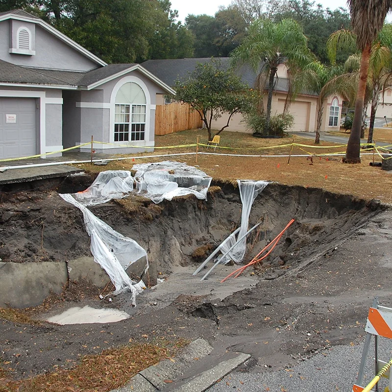
Sinkholes
Sinkholes have both natural and artificial causes. They tend to occur most often in places where water can dissolve the bedrock (especially limestone) below the surface, causing overlying rocks to collapse. Florida, Texas, Alabama, Missouri, Kentucky, Tennessee, and Pennsylvania are most sinkhole-prone.
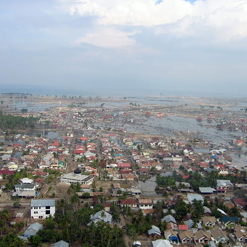
Tsunamis
Tsunamis are destructive waves caused by sudden displacement of ocean water. Tsunamis most often appear on shore as a rapidly receding tide or rapidly rising flood. In the United States, the Pacific coastal states – Oregon, Washington, California, Alaska, and Hawaii – are at greatest risk for destructive tsunamis.
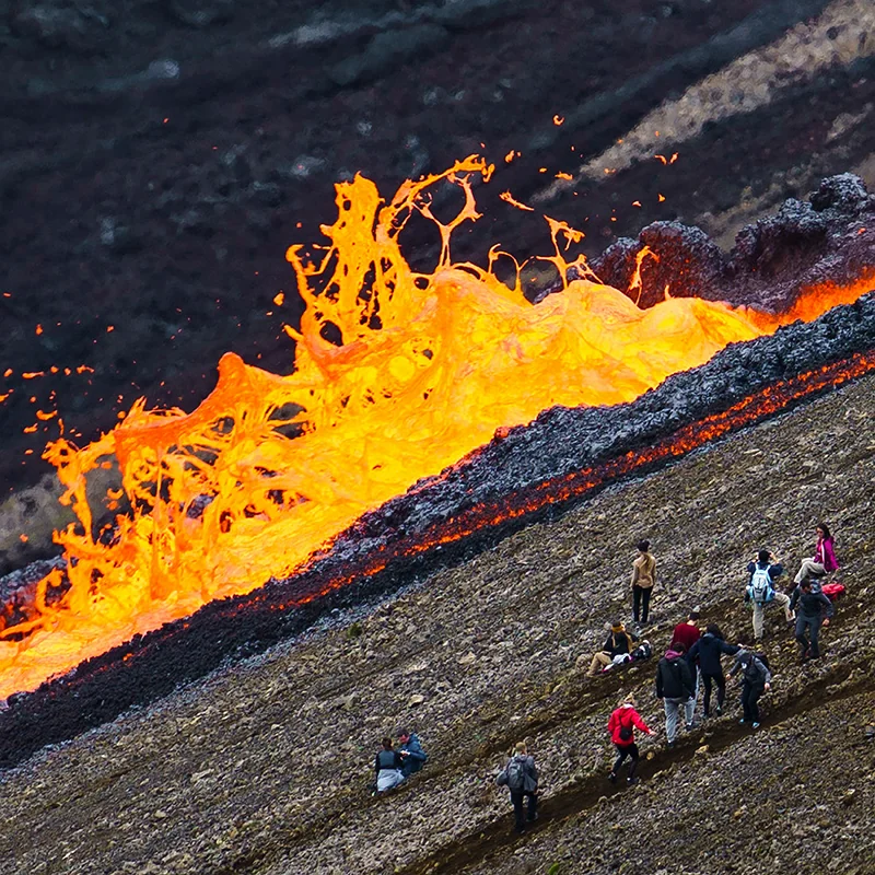
Volcanoes
Volcanoes pose many hazards to their surroundings, from ashfall, mudflows, lava flows, landslides, and associated earthquakes. At least 54 of the United States’ 169 active volcanoes pose major threats to public health and safety and to major industries such as agriculture, aviation, and transportation.
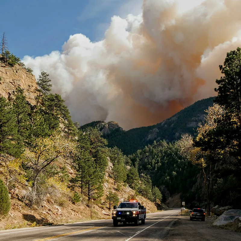
Wildfires
Wildfires are causing more frequent and wider-ranging societal impacts, especially as residential communities continue to expand into wildland areas. Since 2000, there have been twelve wildfires in the United States that have each caused damages exceeding $1 billion; cumulatively, these twelve wildfires have caused a total of $44 billion in damages.