
Geoscience FAQ
What is Lidar and what is it used for?
Information preserved from National Oceanic and Atmospheric Administration.
National Oceanic and Atmospheric Administration
"LIDAR, which stands for Light Detection and Ranging, is a remote sensing method that uses light in the form of a pulsed laser to measure ranges (variable distances) to the Earth. These light pulses—combined with other data recorded by the airborne system— generate precise, three-dimensional information about the shape of the Earth and its surface characteristics.
A LIDAR instrument principally consists of a laser, a scanner, and a specialized GPS receiver. Airplanes and helicopters are the most commonly used platforms for acquiring LIDAR data over broad areas. Two types of LIDAR are topographic and bathymetric. Topographic LIDAR typically uses a near-infrared laser to map the land, while bathymetric lidar uses water-penetrating green light to also measure seafloor and riverbed elevations.
LIDAR systems allow scientists and mapping professionals to examine both natural and manmade environments with accuracy, precision, and flexibility. NOAA scientists are using LIDAR to produce more accurate shoreline maps, make digital elevation models for use in geographic information systems, to assist in emergency response operations, and in many other applications."
LIDAR (sometimes also written as "LiDAR", "Lidar", or "LADAR") is used in a wide range of land management and planning efforts, including hazard assessment (including lava flows, landslides, tsunamis, and floods), forestry, agriculture, geologic mapping, and watershed and river surveys.
LIDAR can also be used in any situation where the structure and shape of Earth's surface needs to be known, and can even measure some gases and particles in the atmosphere. Its versatility and high resolution give it applications in archaeology, climate monitoring, city planning, meteorology, mining, and much more.
Learn More:
- 3D Elevation Program (Website), U.S. Geological Survey
Homepage for 3DEP, an initiative underway to use LIDAR to produce high-resolution 3D maps of almost the entire United States, including both natural and man-made features.
- Lidar (Website), Oregon Department of Geology and Mineral Industries
Homepage for the Oregon DOGAMI's LIDAR program, including background information, ongoing projects, downloadable maps, and a web viewer for LIDAR imagery of the state.
- Lidar (Webpage), Washington Department of Natural Resources
Webpage describing how the Washington DNR uses LIDAR to better understand, monitor, and mitigate natural hazards; the website also provides visitors with free access to LIDAR imagery for the state, where available
- Mapping a Flood...Before it Happens (Factsheet), U.S. Geological Survey
Factsheet explaining how LIDAR can be used to provide high-resolution topographic information that improves the accuracy of flood maps and forecasts.
Explore Related FAQs
Can droughts be predicted?
American Geosciences Institute
Open FAQHow can metal mining impact the environment?
American Geosciences Institute
Open FAQHow do groundwater and surface water interact?
American Geosciences Institute
Open FAQHow do pyrite and pyrrhotite damage building foundations?
American Geosciences Institute
Open FAQHow is ocean acidification affecting sea life?
National Oceanic and Atmospheric Administration
Open FAQWhat are rare earth elements, and why are they important?
U.S. Geological Survey
Open FAQWhat is an Enhanced Geothermal System?
American Geosciences Institute
Open FAQWhat is coalbed methane?
American Geosciences Institute
Open FAQWhat is geoscience?
American Geosciences Institute
Open FAQWhat is surface water and what affects its availability?
American Geosciences Institute
Open FAQWhat kinds of hazards are associated with volcanic eruptions?
American Geosciences Institute
Open FAQWhere can I find flood maps for my area?
American Geosciences Institute
Open FAQWhy and where do earthquakes happen?
American Geosciences Institute
Open FAQExplore Geoscience Intersections
Browse related geoscience intersections pages connected to the topics covered in this FAQ.
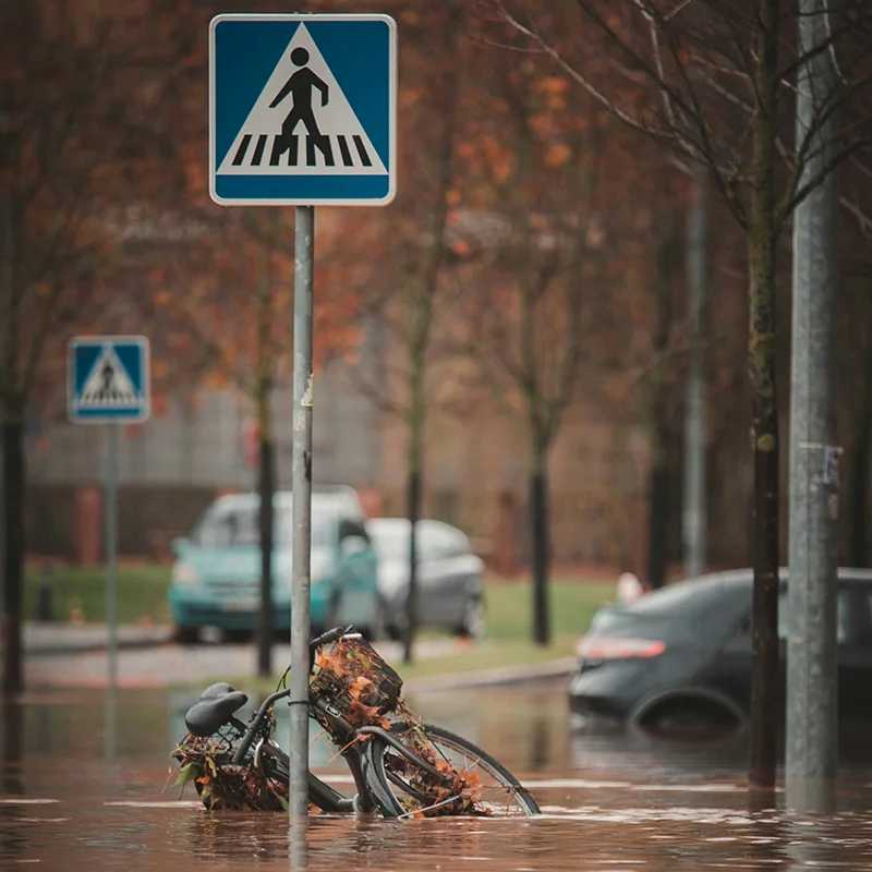
Floods
Flooding is the most common and costliest natural hazard facing the United States. Each year, flooding causes billions of dollars in damages and dozens of deaths nationwide.
Learn more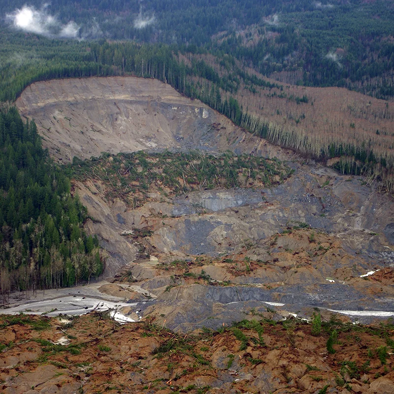
Landslides
Landslides affect all 50 states and U.S. territories, where they cause [25 to 50 deaths and more than $1 billion in damages](https://www.usgs.gov/faqs/how-many-deaths-result-landslides-each-year) each year. Geoscientists study and monitor landslides to identify at-risk areas, prepare populations, and improve our understanding of why, when, and where landslides happen.
Learn more